Point Lonsdale Township Reef
![]() Reef Dive |
Reef Dive | ![]() Shore access
Shore access
![]()
![]()
![]()
![]()
![]()
![]()
Depth: 1 m (3.28 ft) to 5 m (16 ft)
Level: Snorkelling, Open Water and beyond.
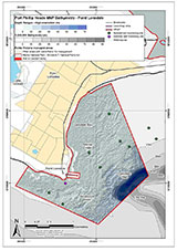
Point Lonsdale Township Reef is is another beginner snorkel dive that is easy to access, when the tide is out. This reef lies just to the south of the Point Lonsdale front beach, where the cliffs begin. After going down the steps from the street parking, just walk along the beach to the South until you come to a small rock platform. Enter the water at a suitable place and follow the shallow reef around to the south. You can dive to any depth up to 5 metres, but if you venture out too far the tidal influence increases. There are lots of small fish that inhabit this low reef, so you may see the unexpected.
Do not dive here on the rising tide as the swell invariably increases as the ebb tide slackens. Do not attempt to dive if there is any hint of a swell, as you may upset the local surfing fraternity.
Location: Point Lonsdale, Victoria 3225
MELWAY Ref: Page 499 K5
Beach Marker: 2B or 3B
See WillyWeather (Port Phillip Heads) as a guide for the tide times and the height of the tide.
The Rip & Tides Warning: Always keep an eye on sea conditions throughout any shore or boat dive within "The Rip" (aka "The Heads"). This is a dangerous stretch of water, where Bass Straight meets Port Phillip, which has claimed many ships and lives. Please read the warnings on the web page diving-the-rip before diving or snorkelling this site.
Port Phillip Heads Marine National Park
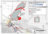
This site lies in the Port Phillip Heads Marine National Park. The park is made up of six separate marine areas around the southern end of Port Phillip: Swan Bay, Mud Islands, Point Lonsdale, Point Nepean, Popes Eye, and Portsea Hole.
Thirty-one of the 120 shipwrecks known to have occurred within a 10 nautical mile radius of Port Phillip Heads are thought to be within the Port Phillip Heads Marine National Park in Point Lonsdale and Point Nepean.
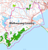
Aboriginal tradition indicates that the Bellarine Peninsula side of the Port Phillip Heads Marine National Park is part of Country of the Wathaurung people, and the Mornington Peninsula side, including Mud Islands, is part of Country of the Boon Wurrung people.
See also, Parks Victoria: Port Phillip Heads Marine National Park,
Park Note: Port Phillip Heads Marine National Park,
Port Phillip Heads Marine National Park - Map,
Divers Guide - Port Phillip Heads Marine National Park,
Port Phillip Heads Marine National Park Identification Booklet, and
Taxonomic Toolkit for the Marine Life of Port Phillip Bay.
You are not permitted to carry a spear gun while snorkelling or scuba diving in Port Phillip Heads Marine National Park.
Traditional Owners — This dive site is in the traditional Country of the Wathaurong (Wadda-Warrung) people of the Kulin Nation. This truly ancient Country includes the coastline of Port Phillip, from the Werribee River in the north-east, the Bellarine Peninsula, and down to Cape Otway in the south-west. We wish to acknowledge the Wathaurong as Traditional Owners. We pay respect to their Ancestors and their Elders, past, present and emerging. We acknowledge Bunjil the Creator Spirit of this beautiful land, who travels as an eagle, and Waarn, who protects the waterways and travels as a crow, and thank them for continuing to watch over this Country today and beyond.
Point Lonsdale Township Reef Location Map
Latitude: 38° 17.205′ S (38.28675° S / 38° 17′ 12.3″ S)
Longitude: 144° 36.967′ E (144.616117° E / 144° 36′ 58.02″ E)
Datum: WGS84 |
Google Map
| Get directions
Added: 2020-07-16 15:27:18 GMT, Last updated: 2022-04-06 19:38:37 GMT
Source: Divers Guide - Port Phillip Heads Marine National Park
Nearest Neighbour: Merlan Inner Reef, 345 m, bearing 100°, E
Port Phillip Heads Marine National Park.
Point Lonsdale, Port Phillip.
Depth: 1 to 5 m.
[ Top ]
DISCLAIMER: No claim is made by The Scuba Doctor as to the accuracy of the dive site coordinates listed here. Should anyone decide to use these GPS marks to locate and dive on a site, they do so entirely at their own risk. Always verify against other sources.
The marks come from numerous sources including commercial operators, independent dive clubs, reference works, and active divers. Some are known to be accurate, while others may not be. Some GPS marks may even have come from maps using the AGD66 datum, and thus may need be converted to the WGS84 datum. To distinguish between the possible accuracy of the dive site marks, we've tried to give each mark a source of GPS, Google Earth, or unknown.

