Wauchope
![]() Wreck Dive |
Wreck Dive | ![]() Boat access
Boat access
![]()
![]()
![]()
![]()
![]()
Two-Masted Wooden Twin-Screw Steamer | Max Depth: 4 m (13 ft)
Level: Open Water and beyond.
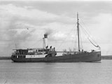
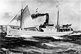
The Wauchope (aka SS Wauchope) was built for the NSW north coast trade, but from 1910 it worked Bass Strait, between King Island, Launceston and Melbourne. Wauchope was the lifeline between the mainland and the rugged Bass Strait island. Wauchope served as a passenger ship and delivered mail, food, machinery and other necessities to the small settlement.
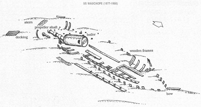
The Wauchope now lies about 500 metres from shore off Sorrento in Port Phillip. The vessel lies on an approximately east-west orientation, with the bow to the east, in a depth of 4 metres.
Diving and Snorkelling the Wauchope Shipwreck
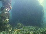
Newspaper reports at the time of the fire on board the SS Wauchope give the impression that the ship was totally destroyed. But, there is still enough of the shipwreck on the seafloor to make this an interesting and worthwhile dive. The site extends for 41.5 m (136 ft) in length. The wreck has an extensive growth of seaweed on and around it and is home to a large population of fish including stingrays.
The SS Wauchope's boiler is the largest feature of the site. In the bow area, there is a good definition of the hull shape and the remains of wooden ribs protrude from the sand. The keelson can be seen extending along the length of the bow, from the deck framing to the boiler. Remains of the propeller shaft and blades can still be seen at the stern along with a small amount of coal. Wooden railing, decking and more ship ribs can also be observed at the stern.
Broken green champagne bottles and black glass whiskey bottlenecks, together with concrete bags lie on the Sorrento side of the hull.
The boiler of the Wauchope is exposed to high and low water and can be seen from Sorrento Boat Ramp.
The wreck lies in shallow water and is best to dive on flood slack for maximum visibility.
Wauchope Shipwreck History — Built in 1905
The Wauchope was a two-masted wooden twin-screw steamer, built in 1905, by D. Sullivan of Coopernook, NSW in Manning, NSW, on the dimensions of 127.5 ft (39 m) long, with a beam of 25.5 ft (7.77 m), and a depth of 9.2 ft (2.8 m). It had a one 22 inch stroke compounded engine making 43 horsepower capable of 10.5 knots (19 kpm).
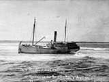
The Wauchope was built for N Cain's Coastal Co-Operative Steamship Co Ltd., Sydney. On 7 April 1908, SS Wauchope ran aground on Port Macquarie bar at Port Macquarie, NSW, and was later refloated. In 1910, she was sold to Stephenson & Gunn of King Island and registered at Launceston Tasmania.
In 1910, the Wauchope was involved in two rescues: ship Carnarvon Bay, King Island; and fishing ketch Unique, lost in western Bass Strait.
In the early 1900s, shipping to King Island was limited because the harbours were small, shallow and narrow and approaches to the small jetties were tricky. The seas of Bass Strait had a reputation for being unpredictable and discouraged all but the most determined seafarers.
In 1911, Wauchope was sold to by King Island Steamers, a subsidiary of William Holyman & Sons.
Sinking — 1 August 1919
On Friday 1 August 1919, Wauchope was anchored at Portsea for a compulsory quarantine stop of seven days due to a 'flu epidemic'. The ship was carrying a cargo of 250 tons including flour, sugar, maize, machinery, one car, drapery, benzine, oil and 28 cylinders of acetylene gas for the lighthouses on King Island.
Five crew and 19 passengers were also on board, under the command of Captain G.Bennett. The Wauchope was manned by 'loyalist' (non-union) crew, due to a bitter seamen's strike. At 7 p.m. that night, as many of the passengers were getting ready for bed, the crew and Captain were frantically trying to extinguish a fire in the fore hold of the ship.
The passengers were alerted and ordered to dress and pack their belongings. Meanwhile, the captain and crew used the ship's water pumps to try and stop the fire spreading. However their task was made difficult because the benzine stored in the hold was fuelling the fire. The captain ordered the crew to lower the two lifeboats for the passengers.
As the fire was gaining the upper hand, the captain signalled two nearby steamers for help. Hall Cain was the first on the scene and towed the passengers and their luggage to safety. A tug, Plover which supplied the Quarantine Station with water came alongside Wauchope and sprayed the water on the flames and into the hold. Still the fire continued to rage.
At 11.00 p.m. the situation looked hopeless and the captain and crew abandoned ship. Of concern to the captain were the gas cylinders which were still stowed on board the ship. In the early hours of the morning the fire became more intense and caused the gas cylinders to explode. After each explosion a great ball of flame rose above the ship. The noise rattled windows at the Quarantine Station and could be heard in Queenscliff and Sorrento.
The next morning, the burned-out remains of Wauchope had drifted toward Sorrento Pier. It was burned to the water line and there was nothing on board to be salvaged. The wreck was eventually sold by auction for £130.
The Court of Marine Inquiry held an investigation into the wreck, but the cause of the fire remained a mystery. Some suspected that the fire was deliberately lit as a protest against the non-union crew. However this was never proven.
See also, Heritage Council Victoria: Wauchope,
Australian National Shipwreck Database: Wauchope, and
Dive Information Sheet: SS Wauchope (1877-1900).
This vessel is one of the many historic shipwrecks included in Victoria's shipwreck-discovery-trail. Qualified divers can explore the wrecks of old wooden clippers, iron steamships and cargo and passenger vessels located along the coast and in Port Phillip. Some of these wreck dives are suitable for beginners, even snorkellers, while other wrecks require the skills and experience of advanced divers.
Heritage Warning: Any shipwreck or shipwreck relic that is 75 years or older is protected by legislation. Other items of maritime heritage 75 years or older are also protected by legislation. Activities such as digging for bottles, coins or other artefacts that involve the disturbance of archaeological sites may be in breach of the legislation, and penalties may apply. The legislation requires the mandatory reporting to Heritage Victoria as soon as practicable of any archaeological site that is identified. See Maritime heritage. Anyone with information about looting or stolen artefacts should call Heritage Victoria on (03) 7022 6390, or send an email to [email protected].
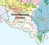
Traditional Owners — This dive site is in the traditional Country of the Boon Wurrung / Bunurong people of the Kulin Nation. This truly ancient Country includes parts of Port Phillip, from the Werribee River in the north-west, down to Wilson's Promontory in the south-east, including the Mornington Peninsula, French Island and Phillip Island, plus Western Port. We wish to acknowledge the Boon Wurrung as Traditional Owners. We pay respect to their Ancestors and their Elders, past, present and emerging. We acknowledge Bunjil the Creator Spirit of this beautiful land, who travels as an eagle, and Waarn, who protects the waterways and travels as a crow, and thank them for continuing to watch over this Country today and beyond.
Wauchope Location Map
Latitude: 38° 19.598′ S (38.326633° S / 38° 19′ 35.88″ S)
Longitude: 144° 44.792′ E (144.746533° E / 144° 44′ 47.52″ E)
Datum: WGS84 |
Google Map
Added: 2012-07-22 09:00:00 GMT, Last updated: 2022-05-07 15:42:33 GMT
Source: Book - Shipwrecks Around Port Phillip Heads GPS (verified)
Nearest Neighbour: Sorrento Boat Moorings, 822 m, bearing 194°, SSW
Two-Masted Wooden Twin-Screw Steamer, 269 ton.
Built: Manning, NSW, 1905.
Sunk: 1 August 1919.
Sorrento, Port Phillip.
Depth: 0 to 4 m.
[ Top ]
DISCLAIMER: No claim is made by The Scuba Doctor as to the accuracy of the dive site coordinates listed here. Should anyone decide to use these GPS marks to locate and dive on a site, they do so entirely at their own risk. Always verify against other sources.
The marks come from numerous sources including commercial operators, independent dive clubs, reference works, and active divers. Some are known to be accurate, while others may not be. Some GPS marks may even have come from maps using the AGD66 datum, and thus may need be converted to the WGS84 datum. To distinguish between the possible accuracy of the dive site marks, we've tried to give each mark a source of GPS, Google Earth, or unknown.

