Point Danger
![]() Reef Dive |
Reef Dive | ![]() Shore access
Shore access
![]()
![]()
![]()
![]()
Depth: 1 m (3.28 ft) to 20 m (66 ft)
Level: Open Water and beyond.
Point Danger is an interesting area of reefs and rock platforms for experienced divers and snorkellers off the Great Ocean Road (B100) at Torquay on Victoria's Surf Coast. Point Danger lies in the Point Danger Marine Sanctuary and extends eastward. The best diving and snorkelling is on the southern side of Point Danger, facing south into Bass Strait.
The Torquay Surf Beach lies just to the west of Point Danger and it has a boating prohibited area out in from of it. Just to the north of Point Danger is the Torquay Front Beach and it too has a boating prohibited area out in from of it. However, there can often be a lot of boat and PWC traffic in the Point Danger area. Always take a dive float with a dive flag. Always go with a buddy and be extremely careful.
Diving and Snorkelling at Point Danger
When weather conditions permit, diving and snorkelling at Point Danger is about exploring the underwater reef terrain and wide-array of marine life. On a perfect day, with no wind, no swell, and no current, it's really worthwhile.
The best diving and snorkelling here is on the southern side of Point Danger. Head south from the sand channel entry point. Here you can hunt for signs of the Joseph H. Scammell shipwreck, though most of what's left is typically covered by sand. The shipwreck area is only 5 metres deep, which makes for long scuba diving run times and easy apnea diving.
At the outer edge of the limestone rock platform there are scattered limestone reefs with with ledges, crevices and large holes. If you stay within the Point Danger Marine Sanctuary the maximum depth is just 7 metres. However, if you venture further south you'll find an offshore network limestone reefs with shelves, overhangs, walls, ledges and swim throughs in 10–20 metres of water.
Location: Anzac Drive, Torquay, Victoria 3228
MELWAY Ref: Page 506 B8
Beach Marker: 66W
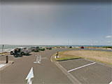
Parking: From Geelong to the north, take the Surf Coast Highway (B100) to Bell Street in Torquay. Turn left onto Bell Street and follow it south. At the end of Bell Street, take the second exit at the roundabout, right onto The Esplanade. At the next roundabout exit onto Anzac Drive which is a large car parking area. Before gearing up check out the water. If you see lots of white water, head on home.
Warning: Weather conditions at Point Danger vary considerably with very strong winds and squalls frequently occurring. This is a highly hazardous area with deep water, rocks and reefs, with a strong rip feeder current running out past the headland. Experienced divers and snorkellers only.
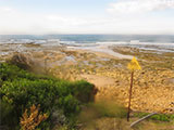
Entry/Exit: At the south-eastern end of the car park you'll find a track and steps down onto the broad low-tide limestone platform at beach marker 66W on the southern side of Point Danger. At low tide you'll see a sandy channel heading south into the ocean which is the best place to enter and exit.
Ideal Conditions: Point Danger is a very exposed shore dive site, so it should only be dived when the seas are flat and calm with very little swell. Conditions are usually best with no wind, or after a few days of northerlies, as surface conditions remain calm.
See WillyWeather (Point Danger) as a guide for the tide times and the height of the tide.
Bass Strait Warning: Always keep an eye on sea conditions throughout any shore or boat dive in Bass Strait on Victoria's coastline. Please read the warnings on the web page diving-in-bass-strait before diving or snorkelling this site.
Point Danger Marine Sanctuary
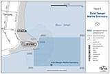
Point Danger Marine Sanctuary (25 ha) is about 20 km south-west of Geelong, close to the township of Torquay and nearby Jan Juc, on Victoria's Surf Coast, facing south-east into Bass Strait. It extends from the high water mark at Point Danger offshore for approximately 600 metres east and 400 metres south, encompassing an offshore rock platform. It protects a shallow limestone reef nestled between two of Torquay's most popular beaches. Here a wide variety of marine creatures shelter amongst small boulders, seaweed beds, crevices and pools.
Sea Slugs at Point Danger Marine Sanctuary
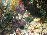
Point Danger Marine Sanctuary is known for its diversity of sea slugs known as Opisthobranchs. Unlike the garden slug, sea slugs can be a range of exquisite shapes, colours and sizes. Over 96 species have been recorded in Point Danger Marine Sanctuary alone. The abundance of these creatures highlights the health of this ecosystem. While sea slugs are common in the sanctuary, it takes a trained eye to spot them as some are only 1–2 mm long.
Other Critters at Point Danger Marine Sanctuary
The crab Hexapus granuliferus and snail Tuberculiopsis septaplia are thought to have their westernmost distribution in the vicinity of Point Danger Marine Sanctuary. Common fish include leatherjackets, toadfish, Blue-Throated Wrasse and stingrays.
Rock Pools at Point Danger Marine Sanctuary
Point Danger Marine Sanctuary provides wonderful opportunities to explore the rock platforms at low tide. Take a look at the diverse range of marine life, with many types of marine organisms to be discovered in the rock pools.
Diving and Snorkelling at Point Danger Marine Sanctuary
Although quite exposed, Point Danger Marine Sanctuary offers good diving and snorkelling when conditions are very calm. Diving around the edge of the rock platform at low tide is particularly interesting. Scuba diving or snorkelling through the kelp forests of the outer reef may reveal schools of fish or rays patrolling. Generally, conditions are best at low tide.
Diving and snorkelling sites inside the Point Danger Marine Sanctuary include Point Danger, plus the Joseph H. Scammell heritage listed shipwreck.
Warning: There is often a lot of boat and PWC traffic in the Point Danger Marine Sanctuary area. Always take a dive float with a dive flag.
How to Get to Point Danger Marine Sanctuary
Point Danger Marine Sanctuary is located between Torquay's surf and front beaches. Torquay is a popular coastal town at the start of the Great Ocean Road (B100) approximately 100 km from Melbourne via the M1 freeway and Great Ocean Road (B100). Rock pools are often accessible at low tide via a sandy beach to the east or stairs leading down from the Memorial carpark.
See also Parks Victoria: Point Danger Marine Sanctuary,
Park Note: Point Danger Marine Sanctuary,
Point Danger Marine Sanctuary Map,
Point Addis Marine National Park, Point Danger Marine Sanctuary, Eagle Rock Marine Sanctuary - Management Plan, and
Point Danger and the Joseph H. Scammell, Torquay in "Shore Dives of Victoria" by Ian Lewis, 3rd edition pages 42–43.
Point Danger, Torquay was probably named by Surveyor George Smythe in 1846. The Point Danger Marine Sanctuary is part of the great-southern-reef.
You are not permitted to carry a spear gun while snorkelling or scuba diving in Point Addis Marine National Park.
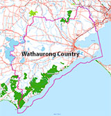
Traditional Owners — This dive site is in the traditional Country of the Wathaurong (Wadda-Warrung) people of the Kulin Nation. This truly ancient Country includes the coastline of Port Phillip, from the Werribee River in the north-east, the Bellarine Peninsula, and down to Cape Otway in the south-west. We wish to acknowledge the Wathaurong as Traditional Owners. We pay respect to their Ancestors and their Elders, past, present and emerging. We acknowledge Bunjil the Creator Spirit of this beautiful land, who travels as an eagle, and Waarn, who protects the waterways and travels as a crow, and thank them for continuing to watch over this Country today and beyond.
Point Danger Location Map
Latitude: 38° 20.445′ S (38.340744° S / 38° 20′ 26.68″ S)
Longitude: 144° 19.614′ E (144.326898° E / 144° 19′ 36.83″ E)
Datum: WGS84 |
Google Map
| Get directions
Added: 2022-04-09 18:25:05 GMT, Last updated: 2022-04-10 01:57:50 GMT
Source: Google Earth
Nearest Neighbour: Joseph H Scammell, 300 m, bearing 147°, SSE
Point Danger Marine Sanctuary.
Torquay, Surf Coast.
Depth: 1 to 10 m.
[ Top ]
DISCLAIMER: No claim is made by The Scuba Doctor as to the accuracy of the dive site coordinates listed here. Should anyone decide to use these GPS marks to locate and dive on a site, they do so entirely at their own risk. Always verify against other sources.
The marks come from numerous sources including commercial operators, independent dive clubs, reference works, and active divers. Some are known to be accurate, while others may not be. Some GPS marks may even have come from maps using the AGD66 datum, and thus may need be converted to the WGS84 datum. To distinguish between the possible accuracy of the dive site marks, we've tried to give each mark a source of GPS, Google Earth, or unknown.

