Gange
![]() Wreck Dive |
Wreck Dive | ![]() Shore access
Shore access
![]()
![]()
![]()
![]()
Three-Masted Iron Barque | Max Depth: 8 m (26 ft)
Level: Open Water and beyond.
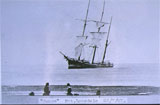
The Gange was a nearly-new, three-masted iron barque on only its second voyage, that was wrecked when it ran aground on Saturday 23 July 1887 on Point Lonsdale Reef.
The Gange shipwreck is historically and socially significant for the interest its wrecking caused in the Victorian community, and the impact the event had on Victorian Pilots Service.
Diving the Gange Shipwreck
The wreck of the Gange lies to the west and seaward of Point Lonsdale Reef, near the Holyhead and George Roper.
The remains of the Gange today are easily recognisable, by the rails and barrels of ruin cement littering the bottom to the South of the outer reef at Point Lonsdale.
The hull of the Gange has broken into two main sections, and though it is quite broken up and flat and there are conspicuous white barrel shaped blocks and other fragments of concrete — remnants of the cargo — that identify the site as being that of the Gange. Some railway iron can also be seen near the site hard up against the reef which may have also been part of the cargo. Wreckage of the Black Boy is also said to be intermingled with that of the Gange and hard to tell apart.
The site is in an area of heavy surge. It is a highly oxygenated white water zone. There is strong surge on the site. As this site is tidal. it's best to dive between the end of the ebb and start of the flood tide.
See WillyWeather (Rip Bank) as a guide for the tide times and the height of the tide.
The Rip & Tides Warning: Always keep an eye on sea conditions throughout any shore or boat dive within "The Rip" (aka "The Heads"). This is a dangerous stretch of water, where Bass Straight meets Port Phillip, which has claimed many ships and lives. Please read the warnings on the web page diving-the-rip before diving or snorkelling this site.
Bass Strait Warning: Always keep an eye on sea conditions throughout any shore or boat dive in Bass Strait on Victoria's coastline. Please read the warnings on the web page diving-in-bass-strait before diving or snorkelling this site.
Gange Shipwreck History — Built in 1885
The Gange was a three-mastered iron barque of 1,071 tons, built in 1885, on the dimensions of 152 ft (46 m) in length, a breadth of 30.1 ft (9.17 m) and a depth of 16.8 ft (5.12 m), by N. Martinloch, Lussin Piccolo on the Gulf of Quarnero, Illyria. The owner of the vessel at the time of its sinking was Eredi Tarabochia of Austria.
Gange Sinking — Wrecked 23 July 1887
On Friday 22 July 1887, the Gange was nearing the completion of a voyage from London to Melbourne, under the command of Captain Ivaneich, with a crew of 17 (mainly Austrian, with one Greek and two Italians), plus one passenger, newly wed Captain Ivaneich's 18-year old wife, Mrs Nilla Ivaneich, on her honeymoon voyage.
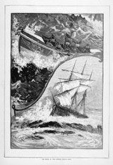
After a voyage of 125 days, at night in squally south-westerly conditions accompanied by rain and hail and a strong ebb tide, the Gange was standing clear of The Heads waiting for a pilot and was burning rockets to attract attention. Captain Ivaneich did not understand a message from one pilot steamer and a boat launched by another failed to get a rope to the barque. The crew of the Gange, meanwhile, were having difficulties with the sails, an ongoing problem during the voyage ascribed by the Captain to the way the vessel had been loaded. As the vessel went to go about a strong squall hit and carried away the foresail sheet, lower topsail and the trysail, and a number of the crew were injured trying to control a vessel.
At this stage, around 9:00 p.m., the Gange was in an extremely perilous position and about to go ashore on Nepean Reef but, due to the risky efforts by the pilots on the schooner Mavis to get close to the barque and lead her westwards out of trouble, this was avoided.
Gradually, the Gange made its way out of danger to the relief of the pilots but unfortunately was now sailing at a rate of five to six knots in a direct line for Point Lonsdale, the Captain believing the blue light the Mavis was burning to lead the Gange out of trouble was to lead him through The Heads. At 11:00 p.m. the ship shook badly, an indication it had grounded. Immediately waves crashed over the decks, flooding the cabins, and Captain Ivaneich ordered the crew to prepare the boats for an opportunity to leave the ship. However, the seas were too heavy and their first priority was to survive by clinging to the rigging. They remained there until midnight, when the Queenscliff lifeboat which had remained anchored near the vessel all night was able to get alongside and rescue off the crew, the Captain and his wife on Saturday 23 July 1887.
Captain Ivaneich (the only person who could speak English among the crew) and the pilots gave conflicting views about the events of that night, the Captain saying he had signalled for a pilot and did not receive one and the pilots saying they were not able to get aboard the Gange as no rope was thrown to them.
However, at the Pilots Board Inquiry, the pilots were exonerated from blame. The press criticised the piloting procedures saying that, like the wreck of the Glaneuse, both large wrecks involved foreign ships and masters who both said they signalled for the assistance of a pilot but did not attain one. Part of the problem was that pilots did not venture for enough out beyond The Heads to meet the ships before they were close to the dangerous entrance.
The Gange was making only its second voyage, consigned to Messrs Robert Virgoe and Co. of Melbourne. The circumstances of loss similar to that of Glaneuse, and there was some comment in the media regarding foreign captains.
The ship broke up during a gale on 7 September 1887 — vessels warned to watch out for floating wreckage. The ship and cargo realised £165 at auction. Not in Lloyds. The wreck of the Gange lies close to the Holyhead and George Roper.
See also, Heritage Council Victoria: Gange,
Australian National Shipwreck Database: Gange, and
The Lonsdale Wrecks in "Shore Dives of Victoria" by Ian Lewis, 3rd edition pages 54–55.
Heritage Warning: Any shipwreck or shipwreck relic that is 75 years or older is protected by legislation. Other items of maritime heritage 75 years or older are also protected by legislation. Activities such as digging for bottles, coins or other artefacts that involve the disturbance of archaeological sites may be in breach of the legislation, and penalties may apply. The legislation requires the mandatory reporting to Heritage Victoria as soon as practicable of any archaeological site that is identified. See Maritime heritage. Anyone with information about looting or stolen artefacts should call Heritage Victoria on (03) 7022 6390, or send an email to [email protected].
Port Phillip Heads Marine National Park
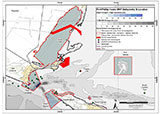
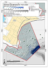
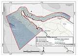
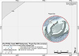
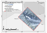
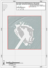
This site lies in the Port Phillip Heads Marine National Park. The park is made up of six separate marine areas around the southern end of Port Phillip: Swan Bay, Mud Islands, Point Lonsdale, Point Nepean, Popes Eye, and Portsea Hole.
Thirty-one of the 120 shipwrecks known to have occurred within a 10 nautical mile radius of Port Phillip Heads are thought to be within the Port Phillip Heads Marine National Park in Point Lonsdale and Point Nepean.
Aboriginal tradition indicates that the Bellarine Peninsula side of the Port Phillip Heads Marine National Park is part of Country of the Wathaurung people, and the Mornington Peninsula side, including Mud Islands, is part of Country of the Boon Wurrung people.
See also, Parks Victoria: Port Phillip Heads Marine National Park,
Park Note: Port Phillip Heads Marine National Park,
Port Phillip Heads Marine National Park - Map,
Divers Guide - Port Phillip Heads Marine National Park,
Port Phillip Heads Marine National Park Identification Booklet, and
Taxonomic Toolkit for the Marine Life of Port Phillip Bay.
You are not permitted to carry a spear gun while snorkelling or scuba diving in Port Phillip Heads Marine National Park.
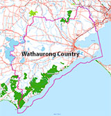
Traditional Owners — This dive site is in the traditional Country of the Wathaurong (Wadda-Warrung) people of the Kulin Nation. This truly ancient Country includes the coastline of Port Phillip, from the Werribee River in the north-east, the Bellarine Peninsula, and down to Cape Otway in the south-west. We wish to acknowledge the Wathaurong as Traditional Owners. We pay respect to their Ancestors and their Elders, past, present and emerging. We acknowledge Bunjil the Creator Spirit of this beautiful land, who travels as an eagle, and Waarn, who protects the waterways and travels as a crow, and thank them for continuing to watch over this Country today and beyond.
Gange Location Map
Latitude: 38° 17.730′ S (38.2955° S / 38° 17′ 43.8″ S)
Longitude: 144° 36.895′ E (144.614917° E / 144° 36′ 53.7″ E)
Datum: WGS84 |
Google Map
| Get directions
Added: 2012-07-22 09:00:00 GMT, Last updated: 2022-05-14 05:36:20 GMT
Source: Book - Shipwrecks Around Port Phillip Heads GPS (verified)
Nearest Neighbour: Holyhead, 36 m, bearing 39°, NE
Three-Masted Iron Barque, 1,071 ton.
Built: Lussinpiccolo, Austria, 1885.
Sunk: 23 July 1887.
Port Phillip Heads Marine National Park.
Port Phillip Heads.
Depth: 5 to 8 m.
Dive only on: SWE, Ebb.
[ Top ]
DISCLAIMER: No claim is made by The Scuba Doctor as to the accuracy of the dive site coordinates listed here. Should anyone decide to use these GPS marks to locate and dive on a site, they do so entirely at their own risk. Always verify against other sources.
The marks come from numerous sources including commercial operators, independent dive clubs, reference works, and active divers. Some are known to be accurate, while others may not be. Some GPS marks may even have come from maps using the AGD66 datum, and thus may need be converted to the WGS84 datum. To distinguish between the possible accuracy of the dive site marks, we've tried to give each mark a source of GPS, Google Earth, or unknown.

